How to use Percept for application
Percept
Percept will allow you to build applications on top of the point cloud it receives from Blickfeld Lidar devices. It uses the 3D information encoded in the point cloud to calculate where objects are and in which directions they are moving or if there is anything in a certain area.
High-Level Overview
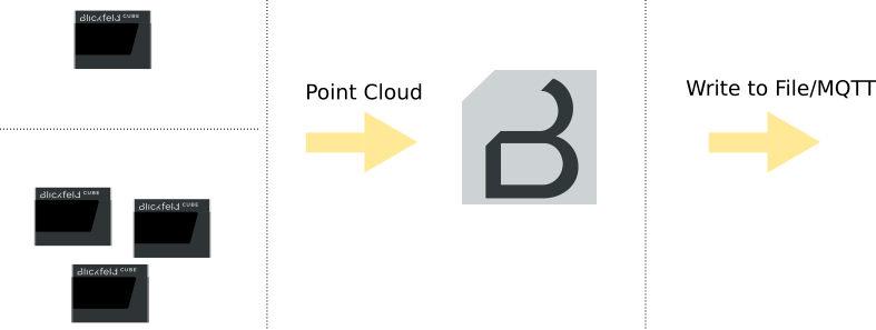
Typically a project setup consists of at least one LiDAR device, which is connected to Percept.
Percept will receive the point cloud/s and process the data based on your configuration and will output the data, so that you can further process or showcase the data in the fashion you like.

Percept Quick Setup Guide
-
Complete hardware setup of Blickfeld LiDAR sensors (Sensor Setup)
-
Install Percept software pre-requisites (Docker, WSL2) on the system you want to use Percept with (Percept Docker Setup).
-
Unzip the provided Percept Software Bundle to a location of your choice on the system and follow the Percept installation instructions.
-
Start the Percept Docker container using the provided docker compose files in the software bundle that suit your operating system (Start Percept Container).
-
Access Blickfeld Percept over the browser (default address: 127.0.0.1) of your choice (Access Web Interface).
-
Create a new project and configure the data inputs. Percept will guide you through the project creation with the so called (Project Wizard). A project in Percept consists of the information needed for the application to process the point cloud data and generate the output data desired.
-
Align the point cloud to the virtual grid in the Percept 3D viewer.
-
Setup object detection zones matching to your needs in the Percept 3D viewer.
-
Configure the desired data output (Output Options). These enable you to further process the data e.g. calculate when an area is crowded the most at a specific time of the day or display the data in your custom dashboard and other endless possibilities to use the data.
After you created your project with Percept you will be able to start, stop, visualize, edit and delete the project. The visualization will show you the point cloud from the connected LiDAR(s) as well as the results from the detection zone in a 3D viewer enabling you to see what is actually being captured.